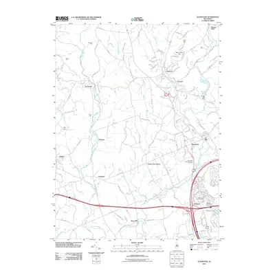
2011 Map of Gladstone
USGS Topo · Published 2011About this map
Lamington River and the North Branch Raritan River carve through this Somerset County landscape, anchoring a network of colonial-era settlements and industrial remnants. In the north, the Wortman Mine and Bartles Mine point to a legacy of mineral extraction, while Potters Falls marks the rugged descent of the Lamington near Pottersville. The mapping of Washington Camp Ground near Pluckemin highlights the area's deep Revolutionary War associations, further supported by the presence of the Pluckemin Presbyterian Church Cemetery.
Find a feature on this map
145 named features on this map. Tap any name to fly to it.
Don’t see what you’re looking for? This feature index may not catch every label — zoom into the map to look around manually.
Map Details
Editions of this 2011 Gladstone Map
This is the sole edition of this map. No revisions or reprints were ever made.
Other maps of this area

1888 · Hackettstown
USGS Topo · 1:62,500

1888 · Lake Hopatcong
USGS Topo · 1:62,500

1890 · High Bridge
USGS Topo · 1:62,500

1891 · Somerville
USGS Topo · 1:62,500

1893 · Somerville
USGS Topo · 1:62,500

1894 · Hackettstown
USGS Topo · 1:62,500

1894 · Lake Hopatcong
USGS Topo · 1:62,500

1898 · Lake Hopatcong
USGS Topo · 1:62,500

1898 · Hackettstown
USGS Topo · 1:62,500

1898 · High Bridge
USGS Topo · 1:62,500
Featured Places
- Bridgewater Township, NJ
- Readington Township, NJ
- Bedminster Township, NJ
- Bernardsville, NJ
- Far Hills, NJ