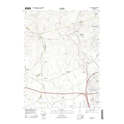
2014 Map of Gladstone
USGS Topo · Published 2014About this map
Peapack and Gladstone and the surrounding Somerset County hill country are defined by a complex network of waterways, including the North Branch Raritan River and the Lamington River. This landscape is marked by historic crossroads like Greater Cross Roads and Vliettown, alongside prominent terrain features such as Mine Mtn. Local heritage is anchored by established religious and community sites, most notably the Mt Saint John complex and several well-documented burial grounds like the Pluckemin Presbyterian Church Cem and the Bedminster Reformed Church Cem. The map illustrates a region where rural land use and suburban expansion meet, visible in the proximity of Somerset Airport to the various boroughs and villages. From the eastern slopes of First Watchung Mtn to the western village of Oldwick, the map provides a look at the residential and transportation patterns that shaped this portion of New Jersey in the early 21st century.
Find a feature on this map
135 named features on this map. Tap any name to fly to it.
Don’t see what you’re looking for? This feature index may not catch every label — zoom into the map to look around manually.
Map Details
Editions of this 2014 Gladstone Map
This is the sole edition of this map. No revisions or reprints were ever made.
Other maps of this area

1888 · Hackettstown
USGS Topo · 1:62,500

1888 · Lake Hopatcong
USGS Topo · 1:62,500

1890 · High Bridge
USGS Topo · 1:62,500

1891 · Somerville
USGS Topo · 1:62,500

1893 · Somerville
USGS Topo · 1:62,500

1894 · Hackettstown
USGS Topo · 1:62,500

1894 · Lake Hopatcong
USGS Topo · 1:62,500

1898 · Lake Hopatcong
USGS Topo · 1:62,500

1898 · Hackettstown
USGS Topo · 1:62,500

1898 · High Bridge
USGS Topo · 1:62,500
Featured Places
- Bridgewater Township, NJ
- Readington Township, NJ
- Bedminster Township, NJ
- Bernardsville, NJ
- Far Hills, NJ