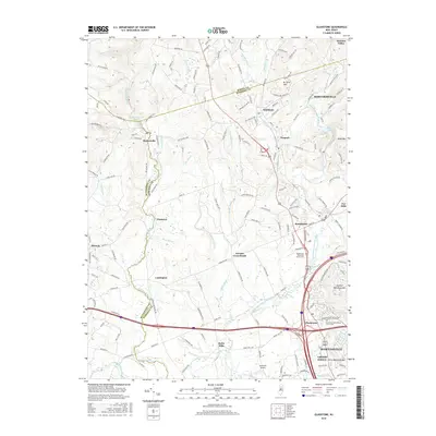
2016 Map of Gladstone
USGS Topo · Published 2016About this map
Pottersville Falls marks the northern reaches of this New Jersey landscape, where the Lamington River winds through a terrain defined by the intersection of Morris, Hunterdon, and Somerset counties. The settlement pattern here reflects deep-rooted agricultural and civic foundations, centered on crossroads like Pottersville, Lamington, and Pluckemin. Along the eastern edge, the topography rises toward Mine Mtn and Second Watchung Mtn, providing a natural boundary to the more densely populated areas near Bernardsville and Peapack. Local history is anchored by sites such as the Bedminster Reformed Church Cem and the Pluckemin Presbyterian Church Cem, preserving the names of the region's early families. Modern infrastructure is represented by the Somerset Airport and the corridor of the North Branch Raritan River, illustrating the evolution from a rural river-valley economy to a more interconnected suburban landscape.
Find a feature on this map
150 named features on this map. Tap any name to fly to it.
Don’t see what you’re looking for? This feature index may not catch every label — zoom into the map to look around manually.
Map Details
Editions of this 2016 Gladstone Map
This is the sole edition of this map. No revisions or reprints were ever made.
Other maps of this area

1888 · Hackettstown
USGS Topo · 1:62,500

1888 · Lake Hopatcong
USGS Topo · 1:62,500

1890 · High Bridge
USGS Topo · 1:62,500

1891 · Somerville
USGS Topo · 1:62,500

1893 · Somerville
USGS Topo · 1:62,500

1894 · Hackettstown
USGS Topo · 1:62,500

1894 · Lake Hopatcong
USGS Topo · 1:62,500

1898 · Lake Hopatcong
USGS Topo · 1:62,500

1898 · Hackettstown
USGS Topo · 1:62,500

1898 · High Bridge
USGS Topo · 1:62,500
Featured Places
- Bridgewater Township, NJ
- Readington Township, NJ
- Bedminster Township, NJ
- Bernardsville, NJ
- Far Hills, NJ