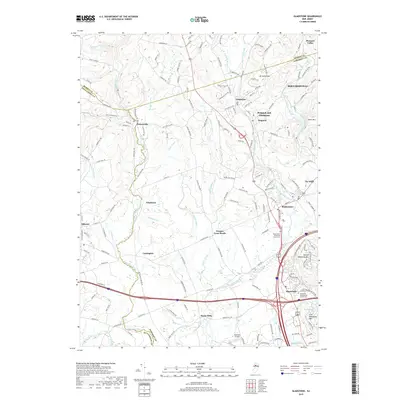
2019 Map of Gladstone
USGS Topo · Published 2019About this map
Peapack and Gladstone serves as a central hub in this landscape where the North Branch Raritan River and Lamington River define the local drainage patterns. The geography is marked by the distinct elevations of Mt Saint John and Mine Mtn to the north, while the southern reaches level out near the Somerset Airport. Historical continuity is evident in the preservation of sites like the Bedminster Reformed Church Cem and Pluckemin Presbyterian Church Cem, which anchor the long-standing communities of Bedminster and Pluckemin. The network of local roads such as Hacklebarney Rd and Pottersville Rd connects smaller hamlets like Vliettown and Greater Cross Roads, illustrating a settlement pattern that balances residential growth with the persistent agricultural and equestrian character of this portion of New Jersey.
Find a feature on this map
148 named features on this map. Tap any name to fly to it.
Don’t see what you’re looking for? This feature index may not catch every label — zoom into the map to look around manually.
Map Details
Editions of this 2019 Gladstone Map
This is the sole edition of this map. No revisions or reprints were ever made.
Other maps of this area

1888 · Hackettstown
USGS Topo · 1:62,500

1888 · Lake Hopatcong
USGS Topo · 1:62,500

1890 · High Bridge
USGS Topo · 1:62,500

1891 · Somerville
USGS Topo · 1:62,500

1893 · Somerville
USGS Topo · 1:62,500

1894 · Hackettstown
USGS Topo · 1:62,500

1894 · Lake Hopatcong
USGS Topo · 1:62,500

1898 · Lake Hopatcong
USGS Topo · 1:62,500

1898 · Hackettstown
USGS Topo · 1:62,500

1898 · High Bridge
USGS Topo · 1:62,500
Featured Places
- Bridgewater Township, NJ
- Readington Township, NJ
- Bedminster Township, NJ
- Bernardsville, NJ
- Far Hills, NJ