2023 Map of Gladstone
USGS Topo · Published 2023About this map
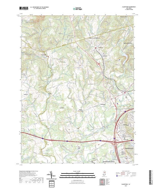
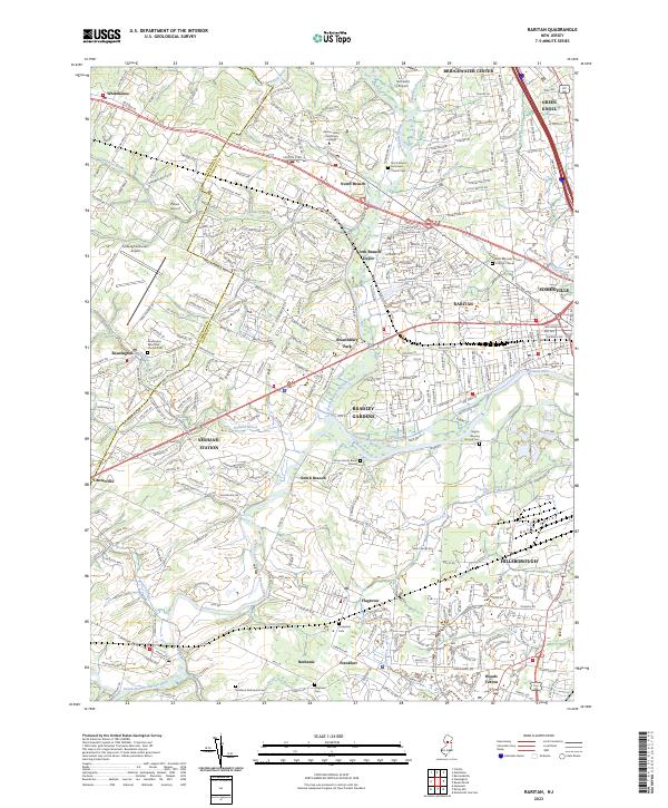
Peapack and Gladstone forms a central cluster of settlements in a landscape where the North Branch Raritan River and its numerous tributaries, such as Peapack Brook and Herzog Brook, define the drainage patterns. This area of Somerset County is characterized by significant topographic relief, including Mine Mtn and the ridges of the Second Watchung Mountain. The map highlights the transition from concentrated townships like Pottersville and Oldwick to more open spaces toward the Somerset Airport. Historical continuity is visible in the placement of the Bedminster Reformed Church Cem and Pluckemin Presbyterian Church Cem, which serve as key points of reference for local genealogy. The complex road network, featuring routes like Pottersville Rd and Mendham Rd, connects these colonial-era settlements across the varied terrain.
Find a feature on this map
161 named features on this map. Tap any name to fly to it.
Don’t see what you’re looking for? This feature index may not catch every label — zoom into the map to look around manually.
Map Details
Editions of this 2023 Gladstone Map
This is the sole edition of this map. No revisions or reprints were ever made.
Historical Maps of Pleasant Valley Through Time
7 maps found
Featured Locations
- Bridgewater Township, NJ
- Far Hills, NJ
- Bedminster Township, NJ
- Bernardsville, NJ
- Readington Township, NJ