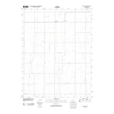
2009 Map of Glasco NE
USGS Topo · Published 2009About this map
Macyville sits at the intersection of rural routes in northern Kansas, serving as the primary anchor for this agricultural landscape. The terrain is defined by a dendritic network of waterways including Fisher Creek and West Branch Wolf Creek, which carve through the section-line road grid. The presence of Morrison Cemetery near the northern border provides a specific point of interest for genealogists tracing early families in Cloud County. This area maintains a classic Midwestern settlement pattern, where small creeks like Coal Creek, Cris Creek, and Mortimer Creek dictate the placement of local farmsteads and field boundaries. The map reflects a deeply established farming community where the naming of even minor tributaries indicates long-standing local ties to the land.
Find a feature on this map
21 named features on this map. Tap any name to fly to it.
Don’t see what you’re looking for? This feature index may not catch every label — zoom into the map to look around manually.
Map Details
Editions of this 2009 Glasco NE Map
This is the sole edition of this map. No revisions or reprints were ever made.
Other maps of this area

1892 · Concordia
USGS Topo · 1:125,000

1892 · Minneapolis
USGS Topo · 1:125,000

1952 · Glasco SW
USGS Topo · 1:24,000

1952 · Glasco
USGS Topo · 1:24,000

1953 · Glasco NE
USGS Topo · 1:24,000

1953 · Simpson
USGS Topo · 1:24,000

1955 · Manhattan
USGS Topo · 1:250,000

1956 · Manhattan
USGS Topo · 1:250,000

1957 · Manhattan
USGS Topo · 1:250,000
1965 · Aurora SW
USGS Topo · 1:24,000