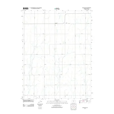
2012 Map of Glasco NE
USGS Topo · Published 2012About this map
Macyville stands as the primary settlement in this north-central Kansas landscape, situated where the high plains are dissected by a network of seasonal drainages. The topography is defined by the headwaters and branches of several significant creeks, including Fisher Cr in the west and W Br Wolf Cr which meanders through the central section. This 2012 survey illustrates the enduring sectional grid system of Cloud County, with a dense network of local roads like Milo Rd, Lark Rd, and Gold Rd providing access to the outlying agricultural land. For those researching local genealogy, the Morrison Cem remains a notable landmark just east of Macyville, serving as a quiet anchor for the community's history amidst the productive fields drained by Coal Cr and Mortimer Cr.
Find a feature on this map
31 named features on this map. Tap any name to fly to it.
Don’t see what you’re looking for? This feature index may not catch every label — zoom into the map to look around manually.
Map Details
Editions of this 2012 Glasco NE Map
This is the sole edition of this map. No revisions or reprints were ever made.
Other maps of this area

1892 · Concordia
USGS Topo · 1:125,000

1892 · Minneapolis
USGS Topo · 1:125,000

1952 · Glasco SW
USGS Topo · 1:24,000

1952 · Glasco
USGS Topo · 1:24,000

1953 · Glasco NE
USGS Topo · 1:24,000

1953 · Simpson
USGS Topo · 1:24,000

1955 · Manhattan
USGS Topo · 1:250,000

1956 · Manhattan
USGS Topo · 1:250,000

1957 · Manhattan
USGS Topo · 1:250,000
1965 · Aurora SW
USGS Topo · 1:24,000