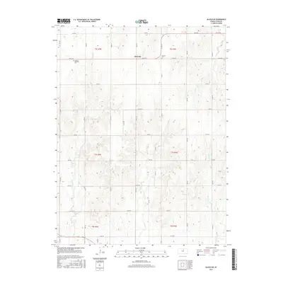
2015 Map of Glasco NE
USGS Topo · Published 2015About this map
Macyville sits at the intersection of sectional boundaries in this part of Cloud County, serving as a focal point for the surrounding agricultural landscape. The terrain is defined by a dense network of drainage systems, including the headwaters of Fisher Cr, Coal Cr, and Cris Cr, which carve through the plains. Local genealogy and history are preserved at sites like the Highland Methodist Cem and Morrison Cem, which mark the early community centers of this rural district. The map illustrates a strictly organized grid of county roads, such as Key Rd and Iron Rd, that facilitate movement between the scattered farmsteads and the various branches of W Br Wolf Cr. This 2015 survey reflects a landscape where the fundamental structure of land division established in the nineteenth century continues to dictate the placement of roads and homesteads.
Find a feature on this map
29 named features on this map. Tap any name to fly to it.
Don’t see what you’re looking for? This feature index may not catch every label — zoom into the map to look around manually.
Map Details
Editions of this 2015 Glasco NE Map
This is the sole edition of this map. No revisions or reprints were ever made.
Other maps of this area

1892 · Concordia
USGS Topo · 1:125,000

1892 · Minneapolis
USGS Topo · 1:125,000

1952 · Glasco SW
USGS Topo · 1:24,000

1952 · Glasco
USGS Topo · 1:24,000

1953 · Glasco NE
USGS Topo · 1:24,000

1953 · Simpson
USGS Topo · 1:24,000

1955 · Manhattan
USGS Topo · 1:250,000

1956 · Manhattan
USGS Topo · 1:250,000

1957 · Manhattan
USGS Topo · 1:250,000
1965 · Aurora SW
USGS Topo · 1:24,000