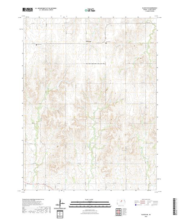
2022 Map of Glasco NE
USGS Topo · Published 2022About this map
Macyville sits at the intersection of several county routes in north-central Kansas, serving as the primary landmark in this rural section of Cloud County. The landscape is defined by the branching drainage systems of Fisher Cr, W Br Wolf Cr, and Cris Cr, which cut through the agricultural sections and section lines. This area reflects a classic Midwestern grid-based land division, where the road network strictly follows the boundaries of townships like T6S R5W and T7S R4W.
Find a feature on this map
26 named features on this map. Tap any name to fly to it.
Don’t see what you’re looking for? This feature index may not catch every label — zoom into the map to look around manually.
Map Details
Editions of this 2022 Glasco NE Map
This is the sole edition of this map. No revisions or reprints were ever made.
Other maps of this area

1892 · Concordia
USGS Topo · 1:125,000

1892 · Minneapolis
USGS Topo · 1:125,000

1952 · Glasco SW
USGS Topo · 1:24,000

1952 · Glasco
USGS Topo · 1:24,000

1953 · Glasco NE
USGS Topo · 1:24,000

1953 · Simpson
USGS Topo · 1:24,000

1955 · Manhattan
USGS Topo · 1:250,000

1956 · Manhattan
USGS Topo · 1:250,000

1957 · Manhattan
USGS Topo · 1:250,000
1965 · Aurora SW
USGS Topo · 1:24,000