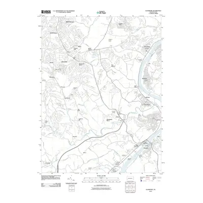
2010 Map of Glassport
USGS Topo · Published 2010About this map
The Monongahela River carves the eastern boundary of this industrial and residential landscape south of Pittsburgh, where the topography transitions from the river valley to the hills of Jefferson Hills and Baldwin. This 2010 survey shows the intense infrastructure supporting the Mon Valley, including the Allegheny County Airport and the concentrated riverfront settlements of Glassport, Clairton, and Elizabeth.
Find a feature on this map
106 named features on this map. Tap any name to fly to it.
Don’t see what you’re looking for? This feature index may not catch every label — zoom into the map to look around manually.
Map Details
Editions of this 2010 Glassport Map
This is the sole edition of this map. No revisions or reprints were ever made.
Other maps of this area

1901 · Amity
USGS Topo · 1:62,500

1902 · Brownsville
USGS Topo · 1:62,500

1904 · Amity
USGS Topo · 1:62,500

1904 · Mc Keesport
USGS Topo · 1:62,500

1904 · Carnegie
USGS Topo · 1:62,500

1906 · Brownsville
USGS Topo · 1:62,500

1906 · Carnegie
USGS Topo · 1:62,500

1907 · Pittsburg
USGS Topo · 1:62,500

1908 · Carnegie
USGS Topo · 1:62,500

1931 · Brownsville
USGS Topo · 1:62,500