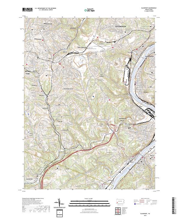
2023 Map of Glassport
USGS Topo · Published 2023About this map
Allegheny County Airport dominates the northern reaches of this industrial and residential landscape south of Pittsburgh. The terrain is deeply carved by the Monongahela River and its tributaries, creating a complex series of valleys and ridges where settlements like Glassport, Clairton, and Dravosburg developed. This survey highlights the region's dense commemorative landscape, featuring numerous religious sites and burial grounds such as the Saint Peters Episcopal Church Columbarium, Mifflin United Presbyterian Church Cem, and the Sacred Heart of Jesus Polish National Catholic Cem.
Find a feature on this map
93 named features on this map. Tap any name to fly to it.
Don’t see what you’re looking for? This feature index may not catch every label — zoom into the map to look around manually.
Map Details
Editions of this 2023 Glassport Map
This is the sole edition of this map. No revisions or reprints were ever made.
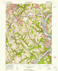
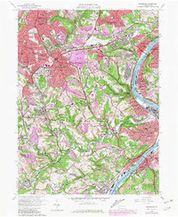
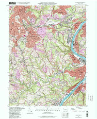
Historical Maps of East Elizabeth Through Time
4 maps found