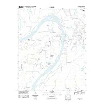
2011 Map of Gleason
USGS Topo · Published 2011About this map
Toad Suck Ferry and the surrounding riverfront communities define this reach of the Arkansas River just west of Conway. This survey captures a landscape of significant hydraulic engineering, featuring numerous water control structures such as the Jones Lake Dam Number Two and the Ouachita Creek Watershed Site One Dam. The map documents established local centers like Gleason and Toad Suck, while providing essential data for genealogists through the locations of Salem Cemetery, Stony Point Cemetery, and Casey Cemetery. To the north, the transition from the Portland Bottoms to the heights of Jefferson Mountain illustrates the varied topography of Faulkner County. Modern residential expansion is evident in the street grids near Lake Carol-Dan, contrasting with the more dispersed rural settlements at Nogal and New Dixie.
Find a feature on this map
100 named features on this map. Tap any name to fly to it.
Don’t see what you’re looking for? This feature index may not catch every label — zoom into the map to look around manually.
Map Details
Editions of this 2011 Gleason Map
This is the sole edition of this map. No revisions or reprints were ever made.
Other maps of this area

1890 · Benton
USGS Topo · 1:125,000

1891 · Little Rock
USGS Topo · 1:125,000

1892 · Morrillton
USGS Topo · 1:125,000

1893 · Little Rock
USGS Topo · 1:125,000

1894 · Morrillton
USGS Topo · 1:125,000

1894 · Benton
USGS Topo · 1:125,000

1953 · Mayflower
USGS Topo · 1:24,000

1955 · Little Rock
USGS Topo · 1:250,000

1956 · Little Rock
USGS Topo · 1:250,000

1956 · Russellville
USGS Topo · 1:250,000