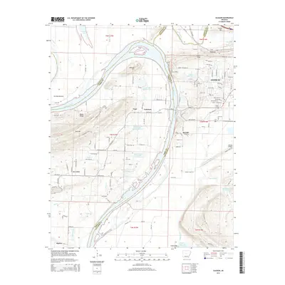
2014 Map of Gleason
USGS Topo · Published 2014About this map
The Arkansas River winds through this 2014 survey, serving as a boundary between Faulkner, Conway, and Perry counties. This riverine landscape is punctuated by prominent terrain features like Jefferson Mtn, Toms Mtn, and Cadron Ridge, which overlook the fertile Portland Bottoms. The settlement pattern is a mix of expanding residential developments in Conway and smaller, established communities such as Gleason, Nogal, and the uniquely named Toad Suck.
Find a feature on this map
129 named features on this map. Tap any name to fly to it.
Don’t see what you’re looking for? This feature index may not catch every label — zoom into the map to look around manually.
Map Details
Editions of this 2014 Gleason Map
This is the sole edition of this map. No revisions or reprints were ever made.
Other maps of this area

1890 · Benton
USGS Topo · 1:125,000

1891 · Little Rock
USGS Topo · 1:125,000

1892 · Morrillton
USGS Topo · 1:125,000

1893 · Little Rock
USGS Topo · 1:125,000

1894 · Morrillton
USGS Topo · 1:125,000

1894 · Benton
USGS Topo · 1:125,000

1953 · Mayflower
USGS Topo · 1:24,000

1955 · Little Rock
USGS Topo · 1:250,000

1956 · Little Rock
USGS Topo · 1:250,000

1956 · Russellville
USGS Topo · 1:250,000