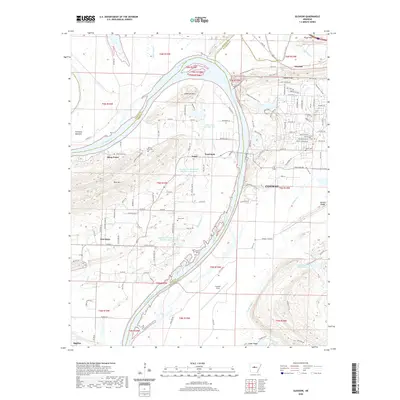
2020 Map of Gleason
USGS Topo · Published 2020About this map
The Arkansas River carves a sweeping arc through this landscape, separating the bottomlands of Portland Bottoms from the rising elevations of Jefferson Mtn and Toms Mtn. This area reflects the transition from the river's fertile floodplain to the residential expansion of western Conway. Local history is anchored by the historic Cadron Settlement Trail and the curiously named community of Toad Suck, situated near a prominent bend in the river. Higher ground is marked by Cadron Ridge and Pisgah Mtn to the north, while the southern reaches contain the extensive Tupelo Bayou drainage system. Genealogists will find interest in several established burial sites, including Stony Point Cem and Salem Cem, which serve as quiet landmarks for the older rural settlements of Stony Point, Gleason, and Nogal. The presence of Cantrell Field further illustrates the modernization of this part of Faulkner County.
Find a feature on this map
112 named features on this map. Tap any name to fly to it.
Don’t see what you’re looking for? This feature index may not catch every label — zoom into the map to look around manually.
Map Details
Editions of this 2020 Gleason Map
This is the sole edition of this map. No revisions or reprints were ever made.
Other maps of this area

1890 · Benton
USGS Topo · 1:125,000

1891 · Little Rock
USGS Topo · 1:125,000

1892 · Morrillton
USGS Topo · 1:125,000

1893 · Little Rock
USGS Topo · 1:125,000

1894 · Morrillton
USGS Topo · 1:125,000

1894 · Benton
USGS Topo · 1:125,000

1953 · Mayflower
USGS Topo · 1:24,000

1955 · Little Rock
USGS Topo · 1:250,000

1956 · Little Rock
USGS Topo · 1:250,000

1956 · Russellville
USGS Topo · 1:250,000