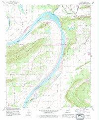
1991 Map of Gleason
USGS Topo · Published 1995About this map
Arkansas River bends sharply through this region, shaping the lowlands of Portland Bottoms and the elevations of Jefferson Mountain. This 1990s revision reveals the intricate navigation and water management systems along the river, most notably the Toad Suck Ferry Lock & Dam. The landscape is a mix of riverine floodplains and ridges like Cadron Ridge, where small rural communities and local landmarks are situated. Settlements such as Gleason and Toad Suck are documented alongside family and community sites like Stony Point Cem and Casey Cem. Several rural congregations, including Pleasant Hill Ch and Bethel Ch, anchor the social geography of the area. The map also records the hydrological complexity of the basin, featuring Cadron Creek, Tupelo Bayou, and Old River Lake, which indicate the shifting course of the primary waterway over time.
Find a feature on this map
38 named features on this map. Tap any name to fly to it.
Don’t see what you’re looking for? This feature index may not catch every label — zoom into the map to look around manually.
Map Details
Editions of this 1991 Gleason Map
This is the sole edition of this map. No revisions or reprints were ever made.
Other maps of this area

1890 · Benton
USGS Topo · 1:125,000

1891 · Little Rock
USGS Topo · 1:125,000

1892 · Morrillton
USGS Topo · 1:125,000

1893 · Little Rock
USGS Topo · 1:125,000

1894 · Morrillton
USGS Topo · 1:125,000

1894 · Benton
USGS Topo · 1:125,000

1953 · Mayflower
USGS Topo · 1:24,000

1955 · Little Rock
USGS Topo · 1:250,000

1956 · Little Rock
USGS Topo · 1:250,000

1956 · Russellville
USGS Topo · 1:250,000