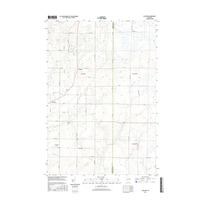
2015 Map of Gleason
USGS Topo · Published 2015About this map
Gleason and Dudley serve as the primary settlement points in this pocket of Northwoods Wisconsin, situated where the Prairie River winds through the landscape. The area is notable for its cultural heritage markers, including the Estonian Cem and Latvian Cem located south of the main village, suggesting the specific European immigrant histories of Lincoln County. The terrain is defined by a complex network of wetlands and water bodies, ranging from the prominent Echo Lake and McGinnis Lake to numerous unnamed marshes. Aviation history is represented by the Haymeadow Airport near Vascheau RD, while the boundary between Lincoln Co and Langlade Co runs vertically through the eastern portion of the survey. This 2015 study captures the modern road network, including family-named routes like Heinemann RD and Friedl RD, alongside the persistent natural flow of Big Hay Meadow Cr and the N Br Pine River.
Find a feature on this map
56 named features on this map. Tap any name to fly to it.
Don’t see what you’re looking for? This feature index may not catch every label — zoom into the map to look around manually.
Map Details
Editions of this 2015 Gleason Map
This is the sole edition of this map. No revisions or reprints were ever made.
Other maps of this area

1899 · Wausau
USGS Topo · 1:125,000

1902 · Wausau
USGS Topo · 1:125,000

1940 · Parrish
USGS Topo · 1:48,000

1950 · Parrish
USGS Topo · 1:48,000

1950 · Tomahawk
USGS Topo · 1:48,000

1951 · Doering
USGS Topo · 1:48,000

1951 · Merrill
USGS Topo · 1:48,000

1952 · Parrish
USGS Topo · 1:48,000

1952 · Tomahawk
USGS Topo · 1:48,000

1954 · Iron Mountain
USGS Topo · 1:250,000