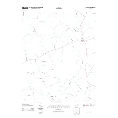
2013 Map of Glen Dean
USGS Topo · Published 2013About this map
Glen Dean and the surrounding rural landscape of Breckinridge County are defined by a network of winding creeks and family-named landmarks. This 2013 survey illustrates a region where life follows the drainage patterns of Clover Cr and Daniels Cr, with small settlements like McQuady and Tar Fork serving as local hubs. The terrain is marked by prominent elevations such as Egypt Knob, Cretcheloe Hill, and Black Jack Knob, which dictate the paths of secondary roads like St Marys Church Rd and Old Axtel-Glen Dean Rd. Genealogists and local historians can find significant markers of the area's heritage, including the Owens Cem and several former school sites indicated by road names like Jackson School. The map shows a transition from the higher knobs down to the stream valleys, preserving the locations of smaller points such as Vanzant, Rockvale, and Dempster amidst the enduring agricultural landscape.
Find a feature on this map
75 named features on this map. Tap any name to fly to it.
Don’t see what you’re looking for? This feature index may not catch every label — zoom into the map to look around manually.
Map Details
Editions of this 2013 Glen Dean Map
This is the sole edition of this map. No revisions or reprints were ever made.
Other maps of this area

1928 · Hardinsburg
USGS Topo · 1:48,000

1931 · Hardinsburg
USGS Topo · 1:62,500

1932 · Fordsville
USGS Topo · 1:62,500

1934 · Cannelton
USGS Topo · 1:62,500

1947 · Hardinsburg
USGS Topo · 1:24,000

1947 · Hardinsburg
USGS Topo · 1:62,500

1953 · Mc Daniels
USGS Topo · 1:24,000

1953 · Hardinsburg
USGS Topo · 1:24,000

1953 · Kingswood
USGS Topo · 1:24,000

1953 · Cloverport
USGS Topo · 1:24,000