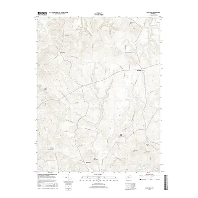
2016 Map of Glen Dean
USGS Topo · Published 2016About this map
Glen Dean and the surrounding rural crossroads of Breckinridge County are defined by a deeply dissected landscape of creeks and high ridges. The settlement pattern follows the drainage of Clover Cr and Rock Lick Cr, with small communities like McQuady, Rockvale, and Vanzant serving as local anchors. Family history is etched into the landscape through numerous named thoroughfares such as Jackson School House Rd, Frank Dean Rd, and Bill Mingus Rd, alongside the solitary Owens Cem near the southern boundary. A notable piece of local industrial history is preserved in the label for Old Railroad Bed Rd, which traces a former transit corridor through the hills. Terrain features such as Egypt Knob, Black Jack Knob, and Knob Lick Hill provide significant vertical relief, illustrating the traditional upland farming and timber environment of this region of Kentucky.
Find a feature on this map
68 named features on this map. Tap any name to fly to it.
Don’t see what you’re looking for? This feature index may not catch every label — zoom into the map to look around manually.
Map Details
Editions of this 2016 Glen Dean Map
This is the sole edition of this map. No revisions or reprints were ever made.
Other maps of this area

1928 · Hardinsburg
USGS Topo · 1:48,000

1931 · Hardinsburg
USGS Topo · 1:62,500

1932 · Fordsville
USGS Topo · 1:62,500

1934 · Cannelton
USGS Topo · 1:62,500

1947 · Hardinsburg
USGS Topo · 1:24,000

1947 · Hardinsburg
USGS Topo · 1:62,500

1953 · Mc Daniels
USGS Topo · 1:24,000

1953 · Hardinsburg
USGS Topo · 1:24,000

1953 · Kingswood
USGS Topo · 1:24,000

1953 · Cloverport
USGS Topo · 1:24,000