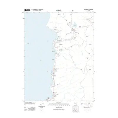
2012 Map of Glenbrook
USGS Topo · Published 2012About this map
The eastern shores of Lake Tahoe are defined here by a series of residential enclaves and historical recreation sites clustered between the water and the rising peaks of the Carson Range. Residential development is concentrated in areas like Glenbrook, Skyland, and Zephyr Cove, while the surrounding geography features prominent landmarks such as Cave Rock and the high summit of Genoa Peak. This 2012 survey illustrates the modern layout of the Glenbrook Golf Course and the complex of state and federal facilities near Spooner Summit, including the Prison Honor Camp and the Spooner Forest Service Facility. Drainage systems such as Logan House Creek and Lincoln Creek cut through steep canyons like Montreal Canyon, framing the localized infrastructure of the Glenbrook Nevada Division of Forestry and multiple public access points including the Lake Tahoe State Park Boat Ramp.
Find a feature on this map
44 named features on this map. Tap any name to fly to it.
Don’t see what you’re looking for? This feature index may not catch every label — zoom into the map to look around manually.
Map Details
Editions of this 2012 Glenbrook Map
This is the sole edition of this map. No revisions or reprints were ever made.
Other maps of this area

1889 · Pyramid Peak
USGS Topo · 1:125,000

1889 · Markleeville
USGS Topo · 1:125,000

1891 · Carson
USGS Topo · 1:125,000

1891 · Markleeville
USGS Topo · 1:125,000

1891 · Truckee
USGS Topo · 1:125,000

1891 · Pyramid Peak
USGS Topo · 1:125,000

1893 · Carson
USGS Topo · 1:125,000

1893 · Markleeville
USGS Topo · 1:125,000

1893 · Truckee
USGS Topo · 1:125,000

1895 · Pyramid Peak
USGS Topo · 1:125,000