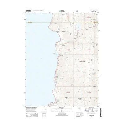
2014 Map of Glenbrook
USGS Topo · Published 2014About this map
Lake Tahoe dominates the western half of this Nevada survey, where the steep slopes of the Carson Range meet the shoreline. Along the eastern edge of the water, a string of established communities including Glenbrook, Lakeridge, and Zephyr Cove sit at the foot of the mountains. This 2014 mapping shows the intense topographical transition from the lakeside settlements to the high peaks of the Toiyabe National Forest. Transportation is centered on Highway 50, which climbs from the shore through Spooner Summit to the east. The map records numerous family-named landmarks and geographic features such as Captain Pomin Rock, Shakespeare Point, and Duane Bliss Peak, reflecting the area's development from early resort and timber origins into a modern residential and recreational corridor. Further south, Round Hill Village and Kingsbury mark the increasing density near the state line.
Find a feature on this map
48 named features on this map. Tap any name to fly to it.
Don’t see what you’re looking for? This feature index may not catch every label — zoom into the map to look around manually.
Map Details
Editions of this 2014 Glenbrook Map
This is the sole edition of this map. No revisions or reprints were ever made.
Other maps of this area

1889 · Pyramid Peak
USGS Topo · 1:125,000

1889 · Markleeville
USGS Topo · 1:125,000

1891 · Carson
USGS Topo · 1:125,000

1891 · Markleeville
USGS Topo · 1:125,000

1891 · Truckee
USGS Topo · 1:125,000

1891 · Pyramid Peak
USGS Topo · 1:125,000

1893 · Carson
USGS Topo · 1:125,000

1893 · Markleeville
USGS Topo · 1:125,000

1893 · Truckee
USGS Topo · 1:125,000

1895 · Pyramid Peak
USGS Topo · 1:125,000