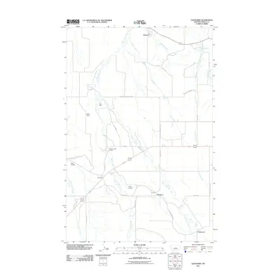
2011 Map of Glengarry
USGS Topo · Published 2011About this map
Glengarry and the surrounding Fergus County ranchlands are defined by a network of seasonal coulees and perennial streams feeding the Judith River basin. The landscape is marked by prominent geological features such as Indian Rock and The Point, which break the drainage patterns of Cottonwood Creek and Coyote Creek. This area of Central Montana maintains a strong connection to its early 20th-century origins, with the small settlements of Hanover and Cottonwood linked by rural thoroughfares like Lower Cottonwood Creek Rd and Cottonwood Cutoff.
Find a feature on this map
31 named features on this map. Tap any name to fly to it.
Don’t see what you’re looking for? This feature index may not catch every label — zoom into the map to look around manually.
Map Details
Editions of this 2011 Glengarry Map
This is the sole edition of this map. No revisions or reprints were ever made.
Other maps of this area

1889 · Big Snowy Mountain
USGS Topo · 1:250,000

1893 · Big Snowy Mountain
USGS Topo · 1:250,000

1941 · Lewistown
USGS Topo · 1:62,500

1944 · Lewistown
USGS Topo · 1:62,500

1954 · Roundup
USGS Topo · 1:250,000

1954 · Lewistown
USGS Topo · 1:250,000

1958 · Roundup
USGS Topo · 1:250,000

1959 · Lewistown
USGS Topo · 1:250,000

1970 · Danvers
USGS Topo · 1:24,000

1970 · Glengarry
USGS Topo · 1:24,000