1970 Map of Danvers
USGS Topo · Published 1973About this map
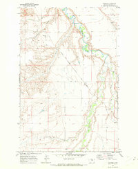
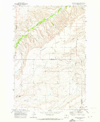
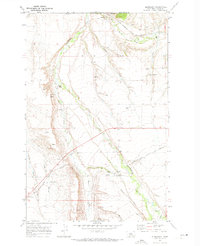
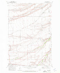
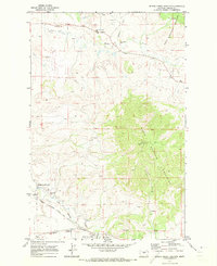
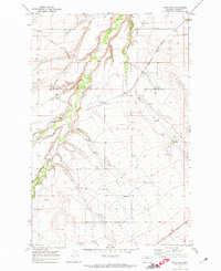
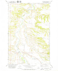
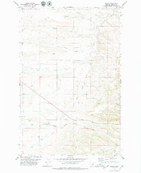
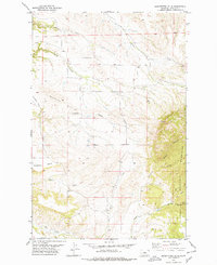
The Judith River meanders through the heart of this Fergus County landscape, cutting a winding path through the breaks as it moved in the early 1970s. The Chicago Milwaukee St Paul and Pacific railroad serves as the primary industrial artery, connecting small agricultural hubs across the plateau. The settlement of Danvers sits along the western edge of the tracks near Scotchman Coulee, while Ware and Amherst provide further evidence of the rail-oriented development that defined the region's ranching and farming economy. Notable local features include a Cem just outside Danvers and various watercourses like Indian Creek, Big Spring Creek, and Louse Creek. The terrain is characterized by a series of coulees and high plains, with the map recording the precise location of local Springs and a Gravel Pit that supported the local infrastructure of the era.
Find a feature on this map
14 named features on this map. Tap any name to fly to it.
Don’t see what you’re looking for? This feature index may not catch every label — zoom into the map to look around manually.
Map Details
Editions of this 1970 Danvers Map
This is the sole edition of this map. No revisions or reprints were ever made.
Other maps of this area

1954 · Lewistown
USGS Topo · 1:250,000

1959 · Lewistown
USGS Topo · 1:250,000
1970 · Harwood Bench
USGS Topo · 1:24,000
1970 · Glengarry
USGS Topo · 1:24,000
1970 · Kolin
USGS Topo · 1:24,000
1970 · Spring Creek Junction
USGS Topo · 1:24,000
1970 · Ross Fork
USGS Topo · 1:24,000
1978 · Toney Bench
USGS Topo · 1:24,000
1978 · Hoosac
USGS Topo · 1:24,000
1978 · Seventytwo Hills
USGS Topo · 1:24,000