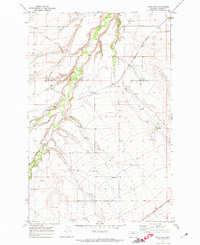
1970 Map of Ross Fork
USGS Topo · Published 1974About this map
The confluence of the Judith River and its tributary forks characterizes this 1970 landscape in central Montana. The settlement of Ross Fork serves as a small rail-side hub where the Burlington Northern line cuts across the drainage basins of Little Rock Creek and Big Rock Creek. The geography here is defined by water access and agricultural infrastructure, evidenced by numerous named springs and the presence of a Storage Bin near the northern rail line. Further southeast, the C M St P & P railroad traverses the territory near the King Colony Ranch. The inclusion of the Wild Rose Sch provides a specific point of interest for those researching local rural education history, while scattered Gravel Pits indicate the small-scale industrial activity supporting the area's development during this era.
Find a feature on this map
13 named features on this map. Tap any name to fly to it.
Don’t see what you’re looking for? This feature index may not catch every label — zoom into the map to look around manually.
Map Details
Editions of this 1970 Ross Fork Map
This is the sole edition of this map. No revisions or reprints were ever made.
Other maps of this area

1889 · Big Snowy Mountain
USGS Topo · 1:250,000

1893 · Big Snowy Mountain
USGS Topo · 1:250,000

1954 · Roundup
USGS Topo · 1:250,000

1954 · Lewistown
USGS Topo · 1:250,000

1958 · Roundup
USGS Topo · 1:250,000

1959 · Lewistown
USGS Topo · 1:250,000

1970 · Harwood Bench
USGS Topo · 1:24,000

1970 · Danvers
USGS Topo · 1:24,000

1970 · Glengarry
USGS Topo · 1:24,000

1970 · Moore
USGS Topo · 1:24,000