
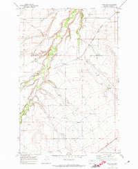
1970 Map of Spring Creek Junction
USGS Topo · Published 1973About this map
The North Moccasin Mountains and South Moccasin Mountains dominate this central Montana landscape, creating a topographic divide between the rolling ranch lands. Along the lower elevations, the Spring Creek Colony and the settlement of Amherst appear near the rail corridor that once served this agricultural region. The infrastructure of 1970 is well-defined, showing the paths of the Chicago Milwaukee St Paul and Pacific and the Burlington Northern railroads as they skirt the base of the peaks.
Find a feature on this map
25 named features on this map. Tap any name to fly to it.
Don’t see what you’re looking for? This feature index may not catch every label — zoom into the map to look around manually.
Map Details
Editions of this 1970 Spring Creek Junction Map
This is the sole edition of this map. No revisions or reprints were ever made.
Other maps of this area

1941 · Lewistown
USGS Topo · 1:62,500

1944 · Lewistown
USGS Topo · 1:62,500

1954 · Lewistown
USGS Topo · 1:250,000

1959 · Lewistown
USGS Topo · 1:250,000

1970 · Danvers
USGS Topo · 1:24,000

1970 · Glengarry
USGS Topo · 1:24,000
1970 · Ross Fork
USGS Topo · 1:24,000

1978 · Toney Bench
USGS Topo · 1:24,000

1978 · Seventytwo Hills
USGS Topo · 1:24,000

1978 · Lewistown
USGS Topo · 1:100,000