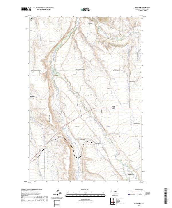
2024 Map of Glengarry
USGS Topo · Published 2024About this map
Glengarry sits at the heart of this Fergus County landscape, where the agricultural plains of Montana meet the distinct topography of the Big Snowy Mountains foothills. The settlement of Hanover anchors the northern reaches of the map near Big Spring Creek, while the King Ranch Colony occupies the western edge, illustrating the enduring presence of communal ranching traditions in the region. The map reveals a complex network of rural infrastructure, including the Cottonwood Cutoff and numerous family-named roads like Machler Ln and McMillan Rd that connect isolated homesteads.
Find a feature on this map
45 named features on this map. Tap any name to fly to it.
Don’t see what you’re looking for? This feature index may not catch every label — zoom into the map to look around manually.
Map Details
Editions of this 2024 Glengarry Map
This is the sole edition of this map. No revisions or reprints were ever made.
Other maps of this area

1889 · Big Snowy Mountain
USGS Topo · 1:250,000

1893 · Big Snowy Mountain
USGS Topo · 1:250,000

1941 · Lewistown
USGS Topo · 1:62,500

1944 · Lewistown
USGS Topo · 1:62,500

1954 · Roundup
USGS Topo · 1:250,000

1954 · Lewistown
USGS Topo · 1:250,000

1958 · Roundup
USGS Topo · 1:250,000

1959 · Lewistown
USGS Topo · 1:250,000

1970 · Danvers
USGS Topo · 1:24,000

1970 · Glengarry
USGS Topo · 1:24,000