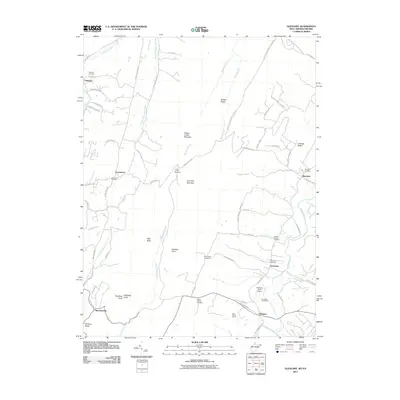
2011 Map of Glengary
USGS Topo · Published 2011About this map
Back Creek and the long ridgelines of the Appalachian Mountains dominate this portion of Berkeley County, where small rural communities like Shanghai, Ganotown, and Glengary follow the valley floor. The settlement pattern here is tied closely to the topography, with Sleepy Creek Mountain and Third Hill Mountain creating distinct natural barriers. In the northern reaches, Oakland sits near the headwaters of the Middle Fork Sleepy Creek, while Shockeysville and the Winding Ridge define the southwestern corner of the quadrangle. For genealogists and local historians, the landscape is dotted with several significant burial grounds, including the Shanghai Cemetery, Mount Carmel Cemetery, and Roe Chapel Cemetery. The presence of the Glengary Post Office and the Michaels Farm Airport highlights the mix of traditional crossroads community life and modern rural infrastructure during the early 21st century.
Find a feature on this map
76 named features on this map. Tap any name to fly to it.
Don’t see what you’re looking for? This feature index may not catch every label — zoom into the map to look around manually.
Map Details
Editions of this 2011 Glengary Map
This is the sole edition of this map. No revisions or reprints were ever made.
Other maps of this area

1894 · Winchester
USGS Topo · 1:125,000

1898 · Paw Paw
USGS Topo · 1:62,500

1899 · Hancock
USGS Topo · 1:62,500

1900 · Pawpaw
USGS Topo · 1:62,500

1901 · Hancock
USGS Topo · 1:62,500

1910 · Paw Paw
USGS Topo · 1:62,500

1914 · Gerrardstown
USGS Topo · 1:48,000

1916 · Gerrardstown
USGS Topo · 1:62,500

1916 · Capon Bridge
USGS Topo · 1:62,500

1923 · Capon Bridge
USGS Topo · 1:62,500