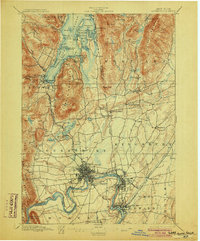
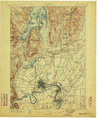
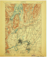
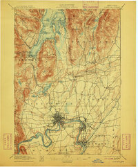
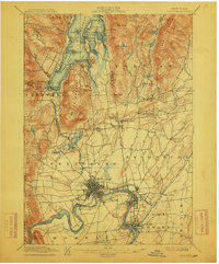
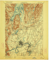
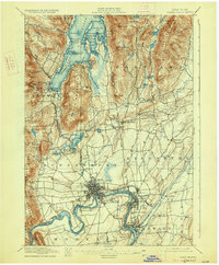
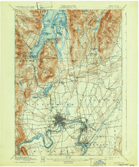
1897 Map of Glens Falls
USGS Topo · Published 1903About this map
The industrial and recreational landscape of the upper Hudson River valley is captured here in detail just before the turn of the century. The hub of Glens Falls and nearby South Glens Falls anchor the southern portion of the map, where the river's power supported growing settlements. To the north, the southern tip of Lake George reveals a different character, marked by the Steamboat Route and a cluster of resort-era landmarks like the Prospect House. This geography highlights the region's transition from colonial military frontier to a nineteenth-century economic engine, preserving the locations of the Fort Wm. Henry Ruins and Fort George Ruins alongside active infrastructure like the Lake George R. R. and the Delaware and Hudson R. R.. Smaller hamlets such as Griswolds Mills and Pattens Mills suggest the importance of local waterpower and milling in the rural townships of Kingsbury and Fort Ann.
Find a feature on this map
98 named features on this map. Tap any name to fly to it.
Don’t see what you’re looking for? This feature index may not catch every label — zoom into the map to look around manually.
Map Details
Editions of this 1897 Glens Falls Map
9 editions found
Other maps of this area

1893 · Fort Ann
USGS Topo · 1:62,500

1893 · Whitehall
USGS Topo · 1:62,500

1895 · Whitehall
USGS Topo · 1:62,500

1895 · North Creek
USGS Topo · 1:62,500

1895 · Cambridge
USGS Topo · 1:62,500

1895 · Fort Ann
USGS Topo · 1:62,500

1895 · Glens Falls
USGS Topo · 1:62,500

1897 · Bolton
USGS Topo · 1:62,500

1897 · Glens Falls
USGS Topo · 1:62,500

1897 · North Creek
USGS Topo · 1:62,500