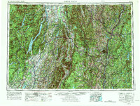
1956 Map of Glens Falls
USGS Topo · Published 1974About this map
Adirondack Mountains and the heights of the Green Mountain National Forest dominate this regional landscape, where the upper Hudson River and Connecticut River basins define the industrial and social character of the mid-20th century. The intricate shoreline of Lake George and the waters of Schroon Lake serve as focal points for recreation, while the Delaware and Hudson RR and Central Vermont Ry trace the valleys that connected mill towns like Glens Falls and Rutland. This edition, revised in the early 1970s, captures the settled corridors between the Adirondack State Park and the New Hampshire border before significant modern interstate expansion altered the rural fabric.
Find a feature on this map
88 named features on this map. Tap any name to fly to it.
Don’t see what you’re looking for? This feature index may not catch every label — zoom into the map to look around manually.
Map Details
Editions of this 1956 Glens Falls Map
3 editions found

Other maps of this area

1889 · Wilmington
USGS Topo · 1:62,500

1891 · Wilmington
USGS Topo · 1:62,500

1891 · Brattleboro
USGS Topo · 1:62,500

1891 · Rutland
USGS Topo · 1:62,500

1893 · Wallingford
USGS Topo · 1:62,500

1893 · Brattleboro
USGS Topo · 1:62,500

1893 · Cohoes
USGS Topo · 1:62,500

1893 · Schenectady
USGS Topo · 1:62,500

1893 · Rutland
USGS Topo · 1:62,500

1893 · Fort Ann
USGS Topo · 1:62,500