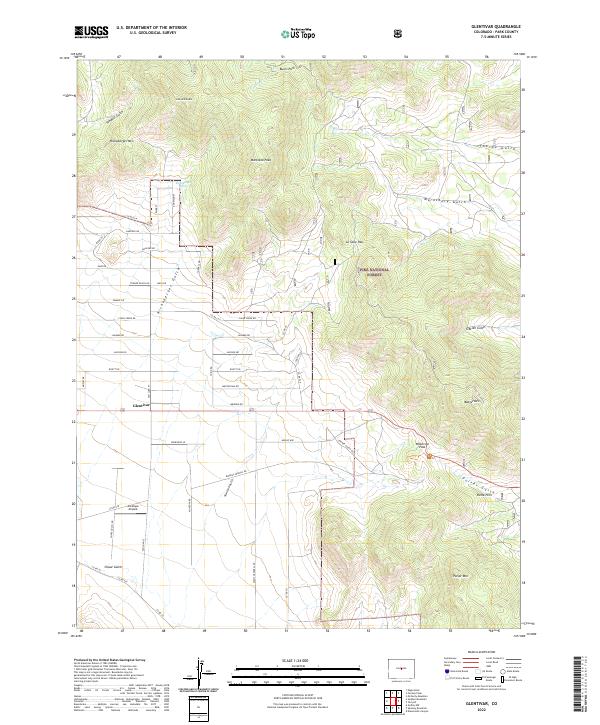
2022 Map of Glentivar
USGS Topo · Published 2022About this map
Glentivar and the surrounding high-altitude Park County landscape are defined by a network of gulches and prominent peaks within the Pike National Forest. The topography is marked by significant transit corridors like Wilkerson Pass and La Salle Pass, which navigate between the Puma Hills and landmarks such as Badger Mtn and Schoolmarm Mtn. The settlement pattern is sparse, largely oriented around rural road systems like Chase Gulch Rd and Turner Gulch Rd, serving isolated ranching interests or recreational access. Notable water features and drainage paths including Rishaberger Spring, Allen Cr, and Pulver Gulch underscore the area's hydrology. The presence of Antelope Airpark near the southwest corner suggests a specialized use of the flat basin floor, contrasting with the steep, named gulches such as Marksbury Gulch and Thorpe Gulch that carve into the surrounding summits.
Find a feature on this map
51 named features on this map. Tap any name to fly to it.
Don’t see what you’re looking for? This feature index may not catch every label — zoom into the map to look around manually.
Map Details
Editions of this 2022 Glentivar Map
This is the sole edition of this map. No revisions or reprints were ever made.
Other maps of this area

1893 · Platte Canyon
USGS Topo · 1:125,000

1894 · Pikes Peak
USGS Topo · 1:125,000

1901 · Pikes Peak
USGS Topo · 1:125,000

1953 · Denver
USGS Topo · 1:250,000

1954 · Pueblo
USGS Topo · 1:250,000

1956 · Eagle Rock
USGS Topo · 1:24,000

1956 · Mc Curdy Mountain
USGS Topo · 1:24,000

1956 · Tarryall
USGS Topo · 1:24,000

1956 · Sulphur Mountain
USGS Topo · 1:24,000

1956 · Elevenmile Canyon
USGS Topo · 1:24,000