
1956 Map of Elevenmile Canyon
USGS Topo · Published 1957About this map
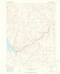
South Platte River waters carve through the heart of the Elevenmile Canyon in this mid-century survey, revealing a landscape defined by ranching and high-altitude recreation. The Elevenmile Canyon Reservoir dominates the western edge, managed by the Pike National Forest. Evidence of early settlement and industry is scattered throughout the drainages, from the Sch (Aban'd) near Link Creek to a Strip Mine and associated Tailings in the north.
Find a feature on this map
40 named features on this map. Tap any name to fly to it.
Don’t see what you’re looking for? This feature index may not catch every label — zoom into the map to look around manually.
Map Details
Editions of this 1956 Elevenmile Canyon Map
5 editions found
Other maps of this area

1893 · Platte Canyon
USGS Topo · 1:125,000

1894 · Pikes Peak
USGS Topo · 1:125,000

1901 · Pikes Peak
USGS Topo · 1:125,000

1953 · Denver
USGS Topo · 1:250,000

1954 · Pueblo
USGS Topo · 1:250,000

1956 · Tarryall
USGS Topo · 1:24,000

1956 · Hackett Mountain
USGS Topo · 1:24,000

1956 · Lake George
USGS Topo · 1:24,000

1956 · Glentivar
USGS Topo · 1:24,000

1956 · Spinney Mountain
USGS Topo · 1:24,000