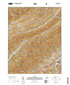
2019 Map of Glenvar
USGS Topo · Published 2019About this map
Jefferson National Forest dominates the high ground in this 2019 survey of the Roanoke valley, where the ridges are traversed by the Appalachian National Scenic Trail and Virginia's Walk. The transition from the rugged highlands near Dragon's Tooth to the developed valley floor reflects the proximity of the Roanoke River and the industrial activity of the Norfolk Southern railroad. Local family history is preserved through numerous rural burial sites scattered throughout the mountains and valleys, including Brillheart Cem, Moore-Bain Cem, and Hall Cem. In the southeastern corner, the community of Glenvar serves as a residential and commercial hub, while smaller settlements like Bradshaw and Wabun remain nestled along the smaller tributaries like Bradshaw Cr and Callahan Br.
Find a feature on this map
77 named features on this map. Tap any name to fly to it.
Don’t see what you’re looking for? This feature index may not catch every label — zoom into the map to look around manually.
Map Details
Editions of this 2019 Glenvar Map
This is the sole edition of this map. No revisions or reprints were ever made.
Other maps of this area

1890 · Christiansburg
USGS Topo · 1:125,000

1923 · Waiteville
USGS Topo · 1:62,500

1929 · Salem
USGS Topo · 1:48,000

1931 · Waiteville
USGS Topo · 1:48,000

1932 · Salem
USGS Topo · 1:62,500

1932 · Blacksburg
USGS Topo · 1:48,000

1937 · Blacksburg
USGS Topo · 1:62,500

1944 · Waiteville
USGS Topo · 1:62,500

1950 · Elliston
USGS Topo · 1:62,500

1951 · Waiteville
USGS Topo · 1:62,500