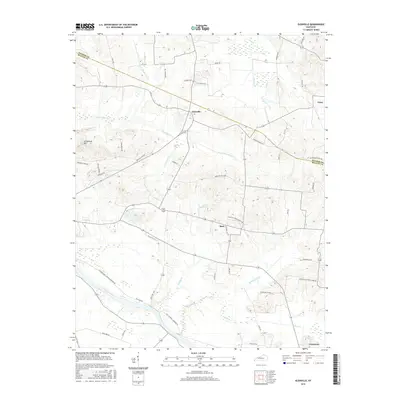
2016 Map of Glenville
USGS Topo · Published 2016About this map
The Green River carves through the southern landscape of this McLean County region, providing a natural anchor for the surrounding agricultural and small-town settlements. Near the river's bend, Livermore serves as a local hub, while further north the rural communities of Glenville and Buel are connected by a network of local roads such as Old Calhoun Livermore Rd. The terrain is defined by the significant drainage systems of Buck Creek and its various forks, creating a rolling topography that includes prominent landmarks like Grindstone Hill.
Find a feature on this map
51 named features on this map. Tap any name to fly to it.
Don’t see what you’re looking for? This feature index may not catch every label — zoom into the map to look around manually.
Map Details
Editions of this 2016 Glenville Map
This is the sole edition of this map. No revisions or reprints were ever made.
Other maps of this area

1906 · Sutherland
USGS Topo · 1:62,500

1908 · Calhoun
USGS Topo · 1:62,500

1909 · Madisonville
USGS Topo · 1:62,500

1909 · Central City
USGS Topo · 1:62,500

1952 · Equality
USGS Topo · 1:24,000

1952 · Livermore
USGS Topo · 1:24,000

1952 · Sacramento
USGS Topo · 1:24,000

1952 · Calhoun
USGS Topo · 1:24,000

1953 · Sutherland
USGS Topo · 1:24,000

1953 · Utica
USGS Topo · 1:24,000