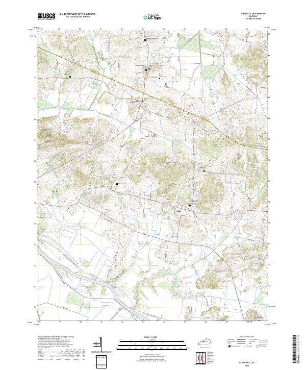
2022 Map of Glenville
USGS Topo · Published 2022About this map
The Green River meanders across the southern boundary of this Kentucky landscape, defining a rural corridor where the borders of Daviess Co and McLean Co converge. This area is characterized by scattered family settlements and agricultural land, with the crossroads of Glenville serving as a central point for the surrounding community. Numerous small family burying grounds, such as the Baird Family Cem and the Leet - Wilhite Family Cem, are tucked away near local tributaries like Long Falls Cr and Miller Cr.
Find a feature on this map
74 named features on this map. Tap any name to fly to it.
Don’t see what you’re looking for? This feature index may not catch every label — zoom into the map to look around manually.
Map Details
Editions of this 2022 Glenville Map
This is the sole edition of this map. No revisions or reprints were ever made.
Other maps of this area

1906 · Sutherland
USGS Topo · 1:62,500

1908 · Calhoun
USGS Topo · 1:62,500

1909 · Madisonville
USGS Topo · 1:62,500

1909 · Central City
USGS Topo · 1:62,500

1952 · Equality
USGS Topo · 1:24,000

1952 · Livermore
USGS Topo · 1:24,000

1952 · Sacramento
USGS Topo · 1:24,000

1952 · Calhoun
USGS Topo · 1:24,000

1953 · Sutherland
USGS Topo · 1:24,000

1953 · Utica
USGS Topo · 1:24,000