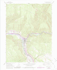
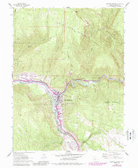
1961 Map of Glenwood Springs
USGS Topo · Published 1984About this map
Glenwood Springs sits at the vital junction of the Colorado River and the Roaring Fork River, serving as a transportation and recreation hub in the 1960s. The Denver and Rio Grande Western Railroad follows the winding river canyon, reflecting the difficult engineering required to navigate this portion of the White River National Forest. Industrial and community history is evident south of the main town at Cardiff, where coke ovens are noted near the Glenwood Airport. Cultural landmarks of the mid-century era, such as a Drive-in Theater and the Glenwood Springs Golf Course, appear alongside the Rosebud Cem and Cemetery Gulch, providing a detailed look at the local geography. Upstream, the terrain rises toward Lookout Mountain, while multiple waterways like Mitchell Creek and No Name Creek feed the main river system.
Find a feature on this map
33 named features on this map. Tap any name to fly to it.
Don’t see what you’re looking for? This feature index may not catch every label — zoom into the map to look around manually.
Map Details
Editions of this 1961 Glenwood Springs Map
6 editions found
Other maps of this area

1927 · Glenwood Springs
USGS Topo · 1:125,000

1930 · Glenwood Springs
USGS Topo · 1:125,000

1957 · Leadville
USGS Topo · 1:250,000

1959 · Leadville
USGS Topo · 1:250,000

1960 · Leadville
USGS Topo · 1:250,000

1961 · Cattle Creek
USGS Topo · 1:24,000

1961 · Carbondale
USGS Topo · 1:24,000

1961 · Shoshone
USGS Topo · 1:24,000

1961 · Glenwood Springs
USGS Topo · 1:24,000

1962 · Leadville
USGS Topo · 1:250,000