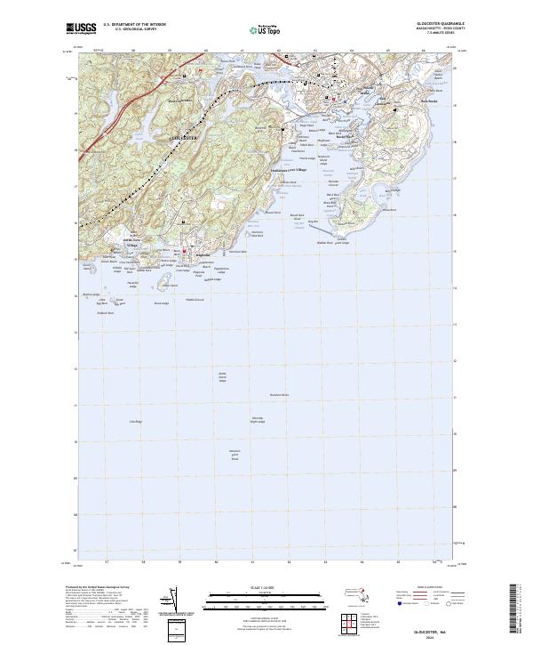
2024 Map of Gloucester
USGS Topo · Published 2024About this map
Gloucester and its historic harbor are the centerpieces of this coastal survey, where the intricate shoreline of Cape Ann meets the Atlantic. The industrial and maritime heart of the area is defined by the Inner Harbor and Blynman Canal, while residential pockets like Freshwater Cove Village and Magnolia dot the surrounding wooded terrain. Genealogists will find a high density of burial sites, ranging from the historic First Parish Burial Ground to the large Oak Grove Cem and Beechbrook Cem. The map illustrates a complex relationship with the sea, featuring numerous navigational points such as Stage Head, Tenpound Island, and the distinctive Rafe's Chasm. Further inland, the landscape transitions from the urbanized harbor to protected basins like Fernwood Lake and Wallace Pond, showing the balance between the fishing port's expansion and the preservation of its marshy interiors like the Harbor-Beach Marshes.
Find a feature on this map
186 named features on this map. Tap any name to fly to it.
Don’t see what you’re looking for? This feature index may not catch every label — zoom into the map to look around manually.
Map Details
Editions of this 2024 Gloucester Map
This is the sole edition of this map. No revisions or reprints were ever made.
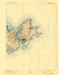
Historical Maps of Freshwater Cove Village Through Time
7 maps found