
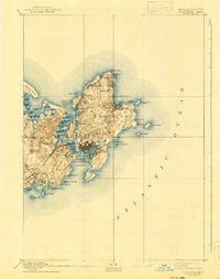
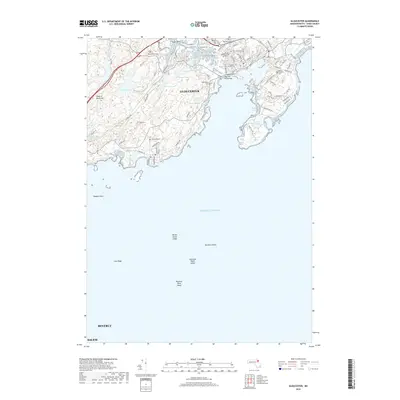
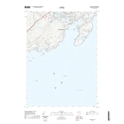
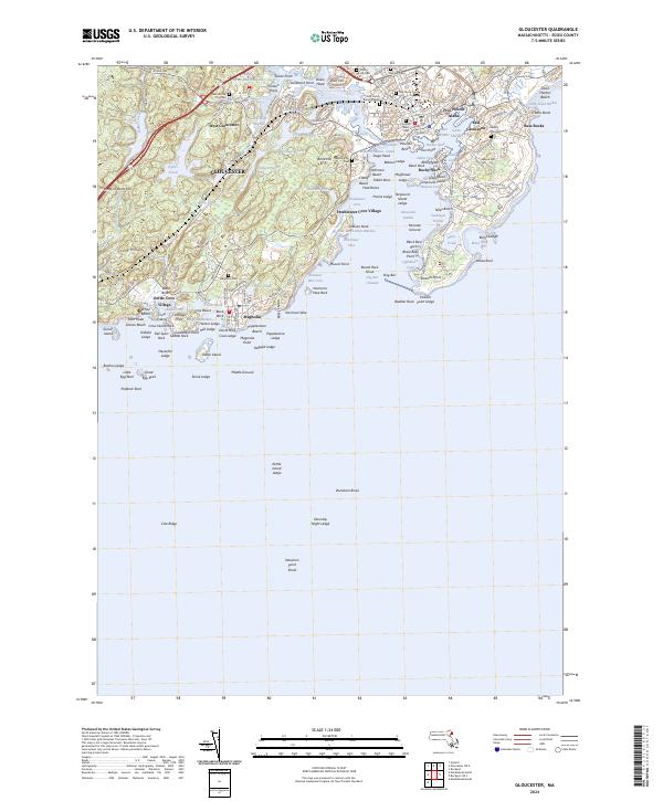
1918 Map of Gloucester
USGS Topo · Published 1921About this map
The coastal fishing and quarrying landscapes of Cape Ann are meticulously charted in this tactical survey, highlighting the intricate shoreline from Halibut Point down to Magnolia Point. The map details a sophisticated network of maritime infrastructure and residential growth, featuring the dense settlement of Gloucester and the distinct granite-quarrying village of Rockport. Navigation aids are clearly marked, including the essential Squam Light at the mouth of Annisquam Harbor. Inland, the terrain is defined by prominent elevations such as Poole Hill and Thompson Hill, which overlook the complex waterways of the Jones River and Squam River. The presence of West Gloucester Sta. and Magnolia Sta. underscores the importance of rail connectivity for these coastal communities during the early 20th century. Maritime hazards and landmarks like Normans Woe Rock and Thatcher I. are documented with bathymetric soundings, reflecting the collaboration between the Corps of Engineers and coastal geodetic surveys.
Find a feature on this map
64 named features on this map. Tap any name to fly to it.
Don’t see what you’re looking for? This feature index may not catch every label — zoom into the map to look around manually.
Map Details
Editions of this 1918 Gloucester Map
This is the sole edition of this map. No revisions or reprints were ever made.
Historical Maps of Salem Through Time
11 maps found

1886 Gloucester
Essex County, MA

1888 Gloucester
Essex County, MA
1893 Gloucester
Essex County, MA
1918 Gloucester
Essex County, MA

1984 Gloucester
Essex County, MA
1984 Gloucester
Essex County, MA
2012 Gloucester
Essex County, MA
2015 Gloucester
Essex County, MA
2018 Gloucester
Essex County, MA
2021 Gloucester
Essex County, MA
2024 Gloucester
Essex County, MA