
Loading...
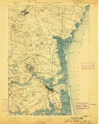
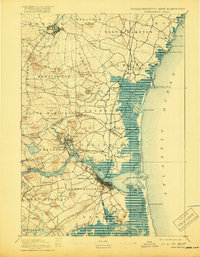
Loading map...1894 Map of Newburyport
USGS Topo · Published 1894About this map
Newburyport and the surrounding coastal marshlands define this late 19th-century study of the Massachusetts and New Hampshire border. The heavy presence of the Boston and Maine Railroad and its various branches, including the Salisbury Branch and Newburyport Branch, illustrates a region deeply connected by rail and tide. The maritime economy is evident along the Merrimac River, where Salisbury Point and Merrimacport sit as established centers of activity near the Newburyport Light.
Find a feature on this map
110 named features on this map. Tap any name to fly to it.
Don’t see what you’re looking for? This feature index may not catch every label — zoom into the map to look around manually.
Map Details
Date Portrayed1894
Date Published1894
PublisherU.S. Geological Survey
Map TypeTopographic
Scale1:62,500
Physical Dimensions17.11 x 19.93 inches
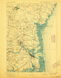
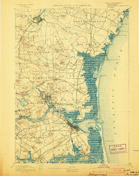
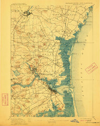
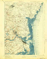
Editions of this 1894 Newburyport Map
7 editions found
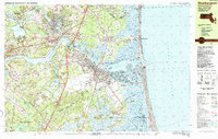
Historical Maps of Haverhill Through Time
5 maps found


Featured Locations
Source Details
SourceU.S. Geological Survey
CopyrightPublic Domain