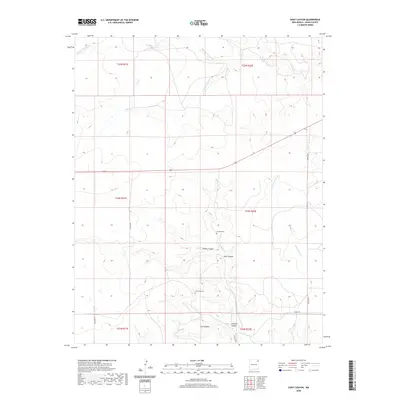
2020 Map of Goat Canyon
USGS Topo · Published 2020About this map
Sanchez Cem and La Morada Cem sit as quiet landmarks in this high-plains landscape of Union County, reflecting the deep-rooted Hispanic heritage of northeastern New Mexico. The terrain is defined by a network of drainage systems including Pinabetes Cr and Middle Trabajo Cr, which have carved significant features such as Chavez Canyon and Goat Canyon. This cattle-ranching country is interlaced with unpaved routes like Barney Rd and several county roads, illustrating a remote settlement pattern where life follows the natural contours of the arroyos. The map provides a look at the land's traditional division, showing the intersection of several townships such as t24n r32e and t23n r32e near Jarosito Canyon.
Find a feature on this map
23 named features on this map. Tap any name to fly to it.
Don’t see what you’re looking for? This feature index may not catch every label — zoom into the map to look around manually.
Map Details
Editions of this 2020 Goat Canyon Map
This is the sole edition of this map. No revisions or reprints were ever made.
Other maps of this area

1954 · Dalhart
USGS Topo · 1:250,000

1958 · Dalhart
USGS Topo · 1:250,000

1962 · Dalhart
USGS Topo · 1:250,000

1966 · Black Canyon
USGS Topo · 1:24,000

1966 · Tate School
USGS Topo · 1:24,000

1966 · Car Top Butte
USGS Topo · 1:24,000

1973 · Snyder Lake
USGS Topo · 1:24,000

1973 · Tripod Mountain
USGS Topo · 1:24,000

1973 · Garcia Creek
USGS Topo · 1:24,000

1973 · Beenham
USGS Topo · 1:24,000