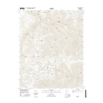
2016 Map of Gobey
USGS Topo · Published 2016About this map
The Emory River valley and its numerous mountain tributaries define the geography of this central Tennessee landscape. Small highland communities and isolated homesteads are connected by a network of winding corridors like Greasy Creek Rd and Gobey Rd, while the high ridges of Grassy Mtn and Richland Mtn dominate the skyline. The area’s genealogical record is preserved in family and church burial grounds, including the Sexton Cem in the north and the Macedonia Cem to the east near the Emory River. Significant local nomenclature is tied to the topography, from the hollows of Sugarcamp Hollow and Mike Hollow to the high points at Potato Knob and High Knob. The rugged drainage system of Brimstone Cr and White Oak Cr illustrates the complex water network that shaped early settlement patterns in this part of Morgan and Scott counties.
Find a feature on this map
92 named features on this map. Tap any name to fly to it.
Don’t see what you’re looking for? This feature index may not catch every label — zoom into the map to look around manually.
Map Details
Editions of this 2016 Gobey Map
This is the sole edition of this map. No revisions or reprints were ever made.
Other maps of this area

1893 · Briceville
USGS Topo · 1:125,000

1895 · Wartburg
USGS Topo · 1:125,000

1895 · Briceville
USGS Topo · 1:125,000

1896 · Wartburg
USGS Topo · 1:125,000

1896 · Briceville
USGS Topo · 1:125,000

1935 · Gobey
USGS Topo · 1:24,000

1935 · Camp Austin
USGS Topo · 1:24,000

1935 · Lancing
USGS Topo · 1:24,000

1935 · Pilot Mountain
USGS Topo · 1:24,000

1936 · Hogbell Gap
USGS Topo · 1:24,000