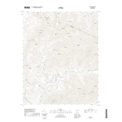
2019 Map of Gobey
USGS Topo · Published 2019About this map
Gobey sits within the complex drainage of the Emory River as it winds through the southern Appalachian highlands. This 2019 survey documents a landscape of numerous named ridges and gaps, where the boundary between Scott Co and Morgan Co follows the high ground of Young Mtn and Wright Mtn. The region's genealogy is preserved in several family-named burial grounds, including McCartt Cem, Hamby Cem, and the Sexton Cem near the northern border. Movement through these steep hollows relies on a network of established routes like Gobey Rd and Macedonia Rd, while the long-distance Cumberland Trail traverses the southern slopes of Thompson Mtn and Bird Mtn. The abundance of small waterways, such as Greasy Creek and Happy Hollow Br, underscores the traditional reliance on river-bottom settlement patterns in this part of Tennessee.
Find a feature on this map
95 named features on this map. Tap any name to fly to it.
Don’t see what you’re looking for? This feature index may not catch every label — zoom into the map to look around manually.
Map Details
Editions of this 2019 Gobey Map
This is the sole edition of this map. No revisions or reprints were ever made.
Other maps of this area

1893 · Briceville
USGS Topo · 1:125,000

1895 · Wartburg
USGS Topo · 1:125,000

1895 · Briceville
USGS Topo · 1:125,000

1896 · Wartburg
USGS Topo · 1:125,000

1896 · Briceville
USGS Topo · 1:125,000

1935 · Gobey
USGS Topo · 1:24,000

1935 · Camp Austin
USGS Topo · 1:24,000

1935 · Lancing
USGS Topo · 1:24,000

1935 · Pilot Mountain
USGS Topo · 1:24,000

1936 · Hogbell Gap
USGS Topo · 1:24,000