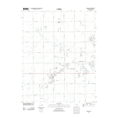
2012 Map of Goddard
USGS Topo · Published 2012About this map
Goddard serves as the primary hub of this Sedgwick County landscape, showing the town's grid and development along the southern edge of the sheet. The area's agricultural roots remain visible through numerous rural cemeteries and small settlements like Saint Marks to the north. These sites, including Saint Mark Cem, Chikaskia Cem, and Afton Cem, offer significant research value for those tracing local families. The map also reveals how land use evolved by the early 21st century, incorporating recreational and tourism-focused spaces such as the Tanganyika Wildlife Park and the All Seasons Campground and Recreational Vehicle Park. Drainage patterns are defined by the intermittent flows of Dry Cr and Afton Cr, while the local aviation infrastructure is represented by Eck Field Airport.
Find a feature on this map
48 named features on this map. Tap any name to fly to it.
Don’t see what you’re looking for? This feature index may not catch every label — zoom into the map to look around manually.
Map Details
Editions of this 2012 Goddard Map
This is the sole edition of this map. No revisions or reprints were ever made.
Other maps of this area

1889 · Cheney
USGS Topo · 1:125,000

1889 · Wichita
USGS Topo · 1:125,000

1891 · Cheney
USGS Topo · 1:125,000

1894 · Wichita
USGS Topo · 1:125,000

1901 · Cheney
USGS Topo · 1:125,000

1941 · Maize
USGS Topo · 1:31,680

1942 · Maize
USGS Topo · 1:31,680

1943 · Wichita West
USGS Topo · 1:31,680

1943 · Bayneville
USGS Topo · 1:31,680

1950 · Bayneville
USGS Topo · 1:24,000