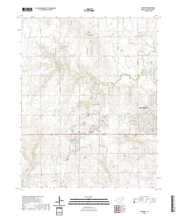
2022 Map of Goddard
USGS Topo · Published 2022About this map
Goddard serves as a central hub in this western Sedgwick County landscape, showing the ongoing suburban transition as the city of Wichita expands from the east. The map captures a blend of established residential grids and remaining agricultural tracts, anchored by the long-standing community of St. Marks to the north. For genealogists and local historians, the area is notably well-marked with historic burial sites, including Saint Marks Cem, Pleasant Ridge Cem, Chikaskia Cem, and Afton Cem, which provide vital touchpoints for tracing early settler families. The drainage patterns of Dry Creek and Afton Creek define the low-lying topography between major thoroughfares like W Kellogg Drive and W 21st Street N. Small aviation history is preserved at Eck Field, situated among the section-line roads that still govern the region's movement.
Find a feature on this map
39 named features on this map. Tap any name to fly to it.
Don’t see what you’re looking for? This feature index may not catch every label — zoom into the map to look around manually.
Map Details
Editions of this 2022 Goddard Map
This is the sole edition of this map. No revisions or reprints were ever made.
Other maps of this area

1889 · Cheney
USGS Topo · 1:125,000

1889 · Wichita
USGS Topo · 1:125,000

1891 · Cheney
USGS Topo · 1:125,000

1894 · Wichita
USGS Topo · 1:125,000

1901 · Cheney
USGS Topo · 1:125,000

1941 · Maize
USGS Topo · 1:31,680

1942 · Maize
USGS Topo · 1:31,680

1943 · Wichita West
USGS Topo · 1:31,680

1943 · Bayneville
USGS Topo · 1:31,680

1950 · Bayneville
USGS Topo · 1:24,000