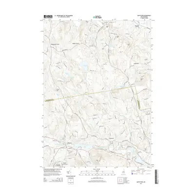
2015 Map of Goffstown
USGS Topo · Published 2015About this map
The Piscataquog River carves through the southern landscape of this New Hampshire region, powering historical industry at Greggs Falls and forming the expansive Glen Lake. The village of Goffstown serves as a focal point, where the notable Goffstown Covered Railroad Bridge remains a landmark of the area's transportation heritage. To the north, the terrain rises toward Uncanoonuc Mountains and Quimby Mtn, while small settlements like Dunbarton Center and Grasmere anchor the rural uplands. This 2015 survey reveals a landscape rich in genealogical markers, featuring numerous burial grounds such as Westlawn Cem and East Dunbarton Cem. The network of brooks, including Black Brook and Bow Bog Brook, illustrates the complex drainage system feeding into the larger river valley, defining the historical boundaries between Merrimack and Hillsborough Counties.
Find a feature on this map
61 named features on this map. Tap any name to fly to it.
Don’t see what you’re looking for? This feature index may not catch every label — zoom into the map to look around manually.
Map Details
Editions of this 2015 Goffstown Map
This is the sole edition of this map. No revisions or reprints were ever made.
Other maps of this area

1905 · Manchester
USGS Topo · 1:62,500

1906 · Milford
USGS Topo · 1:62,500

1921 · Suncook
USGS Topo · 1:62,500

1927 · Concord
USGS Topo · 1:62,500

1941 · Manchester
USGS Topo · 1:62,500

1943 · Lowell
USGS Topo · 1:125,000

1943 · Fitchburg
USGS Topo · 1:125,000

1944 · Suncook
USGS Topo · 1:62,500

1948 · Boston
USGS Topo · 1:250,000

1949 · Portland
USGS Topo · 1:250,000