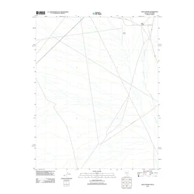
2012 Map of Gold Center
USGS Topo · Published 2012About this map
Gold Center sits at the northern edge of this high-desert landscape in Nye County, marking a site of long-standing interest near the southern end of the Bullfrog Hills. The Amargosa River traces a persistent southward course through the eastern portion of the quadrangle, though its bed remains dry throughout much of the year in this arid environment. Transportation and infrastructure are concentrated in the north, centered around the Beatty Airport and the junction of local routes like Airport Rd. Extending toward the southwest, Chloride Cliff Rd strikes out across the open terrain, suggesting the historical and modern connectivity between the local settlement and the mining districts of the surrounding mountains. The map illustrates a landscape defined by sparse vegetation and significant topographic relief, where water and road access dictate the pattern of human presence.
Find a feature on this map
5 named features on this map. Tap any name to fly to it.
Don’t see what you’re looking for? This feature index may not catch every label — zoom into the map to look around manually.
Map Details
Editions of this 2012 Gold Center Map
This is the sole edition of this map. No revisions or reprints were ever made.
Other maps of this area

1908 · Furnace Creek
USGS Topo · 1:250,000

1910 · Furnace Creek
USGS Topo · 1:250,000

1942 · Bullfrog
USGS Topo · 1:125,000

1948 · Death Valley
USGS Topo · 1:250,000

1952 · Chloride Cliff
USGS Topo · 1:50,000

1952 · Big Dune
USGS Topo · 1:62,500

1954 · Bare Mtn
USGS Topo · 1:62,500

1954 · Bullfrog
USGS Topo · 1:62,500

1954 · Death Valley
USGS Topo · 1:250,000

1956 · Death Valley
USGS Topo · 1:250,000