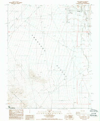
1988 Map of Gold Center
USGS Topo · Published 1988About this map
Gold Center (Site) sits at the northern edge of the Amargosa Desert, marking a point of transition between the river valley and the arid expanses of the high desert. The map captures the course of the ephemeral Amargosa River as it passes east of Beatty Airfield, supported by a local Levee system. This 1980s landscape is defined by its transit and infrastructure history, visible in the Old RR Grade and the prominent Transmission Line cutting across the desert floor. Historical surveyors will find interest in the Von Schmidt Line (1873), which delineates the historic border between Nevada and California. To the southwest, the boundary of Death Valley National Monument begins, while evidence of extraction persists in several Prospect sites and a Borrow Pit near the river.
Find a feature on this map
14 named features on this map. Tap any name to fly to it.
Don’t see what you’re looking for? This feature index may not catch every label — zoom into the map to look around manually.
Map Details
Editions of this 1988 Gold Center Map
This is the sole edition of this map. No revisions or reprints were ever made.
Other maps of this area

1908 · Furnace Creek
USGS Topo · 1:250,000

1910 · Furnace Creek
USGS Topo · 1:250,000

1942 · Bullfrog
USGS Topo · 1:125,000

1948 · Death Valley
USGS Topo · 1:250,000

1952 · Chloride Cliff
USGS Topo · 1:50,000

1952 · Big Dune
USGS Topo · 1:62,500

1954 · Bare Mtn
USGS Topo · 1:62,500

1954 · Bullfrog
USGS Topo · 1:62,500

1954 · Death Valley
USGS Topo · 1:250,000

1956 · Death Valley
USGS Topo · 1:250,000