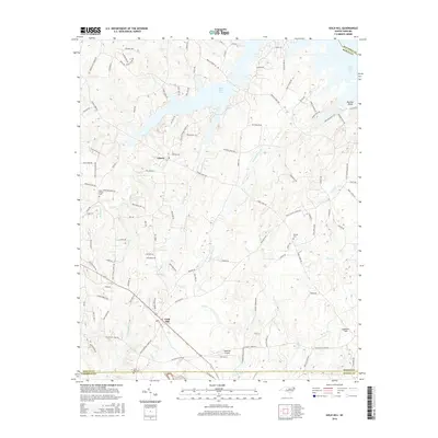
2016 Map of Gold Hill
USGS Topo · Published 2016About this map
Gold Hill and Liberty anchor this landscape along the complex borders of Rowan, Cabarrus, Stanly, and Davidson counties. The terrain is defined by the expansive waters of High Rock Lake and its many finger-like inlets, including those fed by Squirrel Run and Panther Point Cr. This modern survey illustrates the proximity of historical burial grounds such as Saint Peters Cem and Morgan Cem to newer developments and the Gold Hill Airport. The drainage patterns of Little Buffalo Cr, Reedy Cr, and Riles Cr carve through the woodland and fields, while the road network connects these rural pockets to the regional corridor of Highway 52. Notable local landmarks like Panther Point and the curiously named Lonesome Field suggest long-standing local nomenclature preserved through generations of land use.
Find a feature on this map
112 named features on this map. Tap any name to fly to it.
Don’t see what you’re looking for? This feature index may not catch every label — zoom into the map to look around manually.
Map Details
Editions of this 2016 Gold Hill Map
This is the sole edition of this map. No revisions or reprints were ever made.
Other maps of this area

1949 · High Rock
USGS Topo · 1:24,000

1949 · Denton NW
USGS Topo · 1:24,000

1953 · Charlotte
USGS Topo · 1:250,000

1954 · Charlotte
USGS Topo · 1:250,000

1957 · Mount Pleasant
USGS Topo · 1:62,500

1957 · Albemarle
USGS Topo · 1:62,500

1957 · Denton
USGS Topo · 1:62,500

1960 · Charlotte
USGS Topo · 1:250,000

1962 · Charlotte
USGS Topo · 1:250,000

1962 · Southmont
USGS Topo · 1:24,000