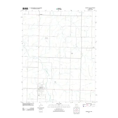
2011 Map of Golden City
USGS Topo · Published 2011About this map
Golden City anchors this portion of Barton County, serving as the primary hub for the surrounding agricultural landscape. The town is laid out on a grid that includes Walnut St and G St, situated just west of where the North Fork Spring River flows southward. The rural character of the area is defined by its drainage systems, with Kyle Creek and Horse Creek feeding into the river. Several small, named communities such as Davenport and Layneville are positioned along the county road network, which is dominated by north-south alignments like NE 100th Ln. This 2011 survey captures a landscape punctuated by family and community burial sites, including the Harlow- Wright Cemetery south of town and the Pippenger Cemetery further north, reflecting the long-standing settlement patterns of this Missouri prairie region.
Find a feature on this map
41 named features on this map. Tap any name to fly to it.
Don’t see what you’re looking for? This feature index may not catch every label — zoom into the map to look around manually.
Map Details
Editions of this 2011 Golden City Map
This is the sole edition of this map. No revisions or reprints were ever made.
Other maps of this area

1886 · Nevada
USGS Topo · 1:125,000

1886 · Stockton
USGS Topo · 1:125,000

1886 · Greenfield
USGS Topo · 1:125,000

1886 · Carthage
USGS Topo · 1:125,000

1888 · Greenfield
USGS Topo · 1:125,000

1894 · Nevada
USGS Topo · 1:125,000

1894 · Carthage
USGS Topo · 1:125,000

1947 · Joplin
USGS Topo · 1:250,000

1949 · Joplin
USGS Topo · 1:250,000

1954 · Springfield
USGS Topo · 1:250,000