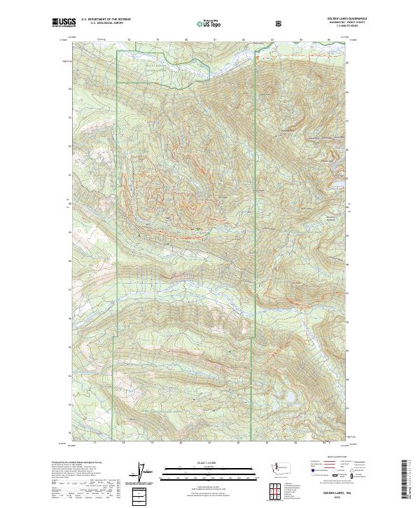
2023 Map of Golden Lakes
USGS Topo · Published 2023About this map
Mount Rainier National Park occupies the eastern half of this terrain, where the high-altitude landscape transitions from the dense Snoqualmie National Forest into protected wilderness. The western slopes are defined by a complex network of forest access routes, specifically the numerous Evans Ck Jeep trails that navigate the drainages of Evans Creek and Voight Creek. This 2023 survey illustrates the modern recreation-heavy management of the area, showing how the historic Wonderland Trail winds past the Golden Lakes and through the Mount Rainier Wilderness. Prominent peaks like Arthur Peak and Tolmie Peak mark the jagged ridgelines between the North Mowich River and Carbon River valleys. The concentration of labeled backcountry paths and named ridges provides a detailed view of the modern infrastructure supporting mountaineering and wilderness exploration in the Northwest.
Find a feature on this map
115 named features on this map. Tap any name to fly to it.
Don’t see what you’re looking for? This feature index may not catch every label — zoom into the map to look around manually.
Map Details
Editions of this 2023 Golden Lakes Map
This is the sole edition of this map. No revisions or reprints were ever made.
Other maps of this area

1897 · Tacoma
USGS Topo · 1:125,000

1900 · Tacoma
USGS Topo · 1:125,000

1913 · Cedar Lake
USGS Topo · 1:125,000

1924 · Mt Rainier
USGS Topo · 1:96,000

1928 · Mt Rainier
USGS Topo · 1:125,000

1937 · Eatonville
USGS Topo · 1:125,000

1942 · Lake Tapps
USGS Topo · 1:62,500

1944 · Lake Tapps
USGS Topo · 1:62,500

1950 · Yakima
USGS Topo · 1:250,000

1953 · Hoquiam
USGS Topo · 1:250,000