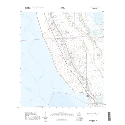
2018 Map of Golden Meadow
USGS Topo · Published 2018About this map
Long, narrow property tracts extend away from the bayou toward the wetlands in this 2018 survey of the Lafourche Parish coast. The settlement pattern follows the high ground along the water, connecting Belle Amie, Galliano, and Golden Meadow via a dense network of residential streets like W 134th St and Miracle Rd. This ribbon of development is anchored by essential community landmarks, including the Louisiana Technical College Galliano Campus and several burial grounds such as Our Lady of Prompt Succor Cem and Cheramie Cem. To the east, the South Lafourche Leonard Miller Junior Airport sits adjacent to the vast marshlands. Movement across the water is facilitated by the South Lafourche Bridge, Galliano Bridge, and the Golden Meadow Bridge, while the surrounding geography is defined by a complex hydraulic system including Breton Canal and Grand Bayou Blue.
Find a feature on this map
84 named features on this map. Tap any name to fly to it.
Don’t see what you’re looking for? This feature index may not catch every label — zoom into the map to look around manually.
Map Details
Editions of this 2018 Golden Meadow Map
This is the sole edition of this map. No revisions or reprints were ever made.
Other maps of this area

1892 · Barataria
USGS Topo · 1:62,500

1892 · Cut-Off
USGS Topo · 1:62,500

1892 · Creole
USGS Topo · 1:62,500

1894 · Lake Felicity
USGS Topo · 1:62,500

1935 · Viguerie Canal
USGS Topo · 1:31,680

1935 · Bay Courant
USGS Topo · 1:31,680

1935 · Golden Meadow
USGS Topo · 1:31,680

1935 · Mink Bayou
USGS Topo · 1:31,680

1939 · Cut-Off
USGS Topo · 1:62,500

1939 · Lake Felicity
USGS Topo · 1:62,500