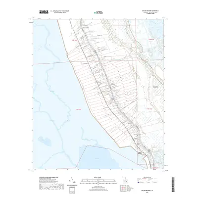
2020 Map of Golden Meadow
USGS Topo · Published 2020About this map
Bayou Lafourche serves as the central artery for this portion of southern Louisiana, dictating a unique ribbon-like settlement pattern. Long, narrow property tracts stretch perpendicular from the water, a remnant of traditional French land division. The communities of Galliano, Belle Amie, and Golden Meadow form a continuous corridor of development along the banks. This survey shows the transition from these inhabited levees into the surrounding wetlands and water bodies, including Catfish Lake, Grand Bayou, and Lake Cheniere. Connectivity is maintained through engineering feats like the South Lafourche Bridge, Galliano Bridge, and Golden Meadow Bridge. For those tracing local families, several small burial grounds such as Cheramie Cem, Hebert Cem, and Our Lady of Prompt Succor Cem are clearly marked along the bayou corridor, preserving the locations of historical parish roots in this coastal landscape.
Find a feature on this map
84 named features on this map. Tap any name to fly to it.
Don’t see what you’re looking for? This feature index may not catch every label — zoom into the map to look around manually.
Map Details
Editions of this 2020 Golden Meadow Map
This is the sole edition of this map. No revisions or reprints were ever made.
Other maps of this area

1892 · Barataria
USGS Topo · 1:62,500

1892 · Cut-Off
USGS Topo · 1:62,500

1892 · Creole
USGS Topo · 1:62,500

1894 · Lake Felicity
USGS Topo · 1:62,500

1935 · Viguerie Canal
USGS Topo · 1:31,680

1935 · Bay Courant
USGS Topo · 1:31,680

1935 · Golden Meadow
USGS Topo · 1:31,680

1935 · Mink Bayou
USGS Topo · 1:31,680

1939 · Cut-Off
USGS Topo · 1:62,500

1939 · Lake Felicity
USGS Topo · 1:62,500